TomTom's AI-Native Mapping Shapes Future of Driving
TomTom is strengthening its collaboration with CARIAD – the automotive software arm of Volkswagen Group – as both companies double down on AI-powered, map-based technology to support large-scale automated driving.
Volkswagen Group now standardises TomTom’s Orbis Maps as a central part of CARIAD’s automated driving system architecture.
The move sees high-definition, cloud-connected mapping embedded into the core vehicle software used across multiple Volkswagen Group brands. As a result, spatial intelligence becomes continuously updated and available across the carmaker’s future vehicle range.
Orbis Maps adds new layer to vehicle automation
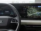
TomTom Orbis Maps is set to become a key element in CARIAD’s integrated vehicle software stack. The platform functions as a map-based layer that operates alongside vehicle sensors such as radar, lidar and cameras.
This map layer supplies precise, constantly refreshed location data to improve how vehicles perceive and respond to their environment.
Orbis Maps does not replace in-car sensors, instead adding what TomTom calls “fundamental spatial context,” including detailed and consistent information about road layouts, speed limits and lane positions – data that can be hard for sensors to identify accurately under all conditions.

Such context becomes vital for supporting safety-critical systems in vehicles. These include Intelligent Speed Assistance, which monitors speed limits and vehicle compliance, and hands-free driving features that depend on reliable data for decision-making during complex driving scenarios.
The integration means vehicle systems can behave in more predictable, human-like ways – especially when traffic environments become more dynamic or difficult to interpret through sensors alone.
Mapping becomes central to AI-based vehicle perception
CARIAD views maps as essential to its future plans for AI and automated systems.
Francisco Ramon Moreno Garcia, Head of Maps at CARIAD, explains: “High-quality and fresh maps are a foundational part of safe and scalable automated driving today.
"As AI perception continues to advance, maps stay important as contextual layers that enhance what the sensors see in real time.”
This points to a wider industry shift towards hybrid models of perception – combining sensor inputs with map intelligence. Such an approach offers both greater robustness and clearer decision paths for automated systems.
In complex or unpredictable driving situations, a high-quality map can provide the missing link to support safe decisions.
Mike Schoofs, Chief Revenue Officer at TomTom, comments: “This is a testament to the strength of our product and the depth of our technical collaboration with CARIAD.
"TomTom brings not only cutting-edge technology but also the ability to deliver solutions that meet Volkswagen Group’s evolving needs. This collaboration reinforces our leadership in the future of driving.”
By aligning perception with a high-fidelity, real-time map layer, TomTom and CARIAD are bidding to enhance automated decision-making while also improving how those decisions are explained and verified.
How TomTom builds AI-native maps at scale
The capability behind Orbis Maps comes from TomTom’s AI-native mapping platform. This system is built from the ground up to support real-time, collaborative mapping at scale, with features designed specifically for the demands of automated driving.
TomTom’s platform constructs detailed lane geometry and behavioural attributes – such as turn restrictions and driving patterns – at lane level. These attributes connect to an open, stable map standard that allows input from multiple partners and developers, giving the entire system flexibility for future integration.
Map updates occur using a mix of data sources, including vehicle sensors, aerial imagery and data from survey vehicles, ensuring Orbis Maps remains detailed and widely applicable. The platform updates at minute-level intervals, allowing it to respond quickly to changes and feed the latest information back into vehicle systems.

With coverage now spanning over 235 countries and territories and all road classifications, Orbis Maps delivers global mapping at a pace compatible with regular vehicle software update cycles.
For TomTom and CARIAD, the collaboration falls under long-term strategic effort, rather than short-term product deal. TomTom is successfully positioning itself as a full-stack map provider for OEMs and developers, offering tools such as APIs, software development kits (SDKs), routing systems and real-time traffic feeds.
Company portals


Executives

Francisco Ramon Moreno Garcia
Head of Maps

Mike Schoofs
CRO